15.5 Impact Mapping
It is often necessary to carry out a comparison of results between two or more model simulations. For example, to quantify the impact of a proposed development on the predicted flood extent and flood depths, or assess the sensitivity of the model due to changes in one of the parameters. A number of the TUFLOW utilities (refer to Section 17) may be used to carry out this comparison. For example, the ASC_to_ASC utility may be used to compare the results contained in two grid output file (TIF, FLT or ASC formats). This utility outputs two result grids, shown in Figure 15.5:
- A difference grid subtracting the second input grid from the first; and
- A second grid with a “_wd” suffix, denoting locations where the model was previously wet and now dry, and vice versa.
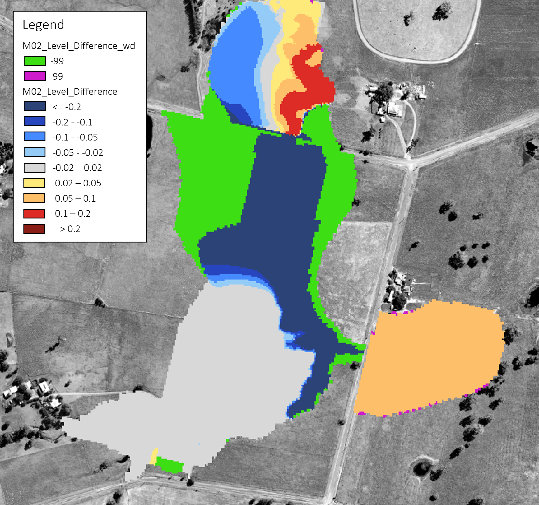
Figure 15.5: Impact Mapping
An example of using the ASC_to_ASC utility to create an impact grid is available in the TUFLOW Tutorial Module 2.
Alternatively, the RES_to_RES utility may be used. Rather than comparing grid output, the RES_to_RES compares mesh result files (e.g. .xmdf format) for a single timestep or all timesteps in the model simulation. Note, unlike ASC_to_ASC, RES_to_RES is limited to comparing model results with the same underlying .2dm mesh file.
Further information on ASC_to_ASC, RES_to_RES and the other TUFLOW utilities are discussed in Chapter 17, with more detail and examples via the TUFLOW Wiki Utilities page.