1. Required Settings
The required settings tab of the tool contains all mandatory inputs for the tool to run. Unless listed as (Optional), the parameters on this tab are required.
1.1 Inputs
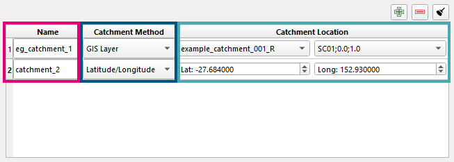
The input catchments are specified in a table with one row per catchment. Rows can be added, removed or cleared using the add , remove and clear buttons above the table.
Each row has:
-
Name the catchment/site name. This is used to name the tools output files.
-
Catchment Method the method for defining the Catchment Location. Either:
-
GIS Layer: select the polygon layer and the specific feature from the comboboxes.
-
Latitude/Longitude: manually enter a latitude and longitude which represent the centre of the catchment.
-
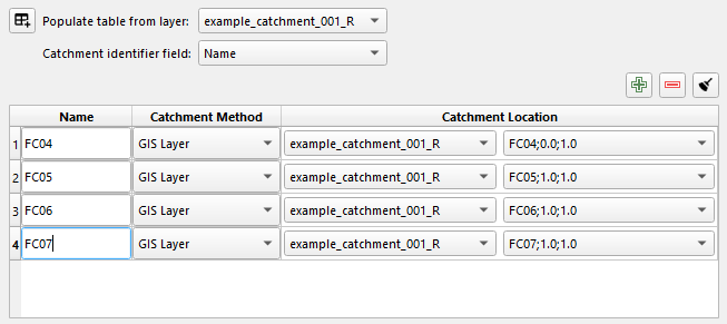
To avoid having to populate the table one row at a time, there is an option to add multiple rows at once from a GIS polygon layer. Specify the polygon layer and the field to use as the catchment identifier and then click the button. This will add one row per feature to the table. The catchments will be named using the values from the identifying field.
For example, in the image below, the GIS polygon layer example_catchment_001_R has the identifying field Name which contains FC04, FC05, etc.
1.1.1 Outlet Location (Optional)
Providing an outlet location is an optional input to the ARR Data Hub since the 2026 v1 update. An outlet location is only used for jurisdiction-sensitive layers (IFD, storm losses, preburst, ARF). The outlet location can be provided from a GIS point layer or by inputing the location as long/lat coordinates.
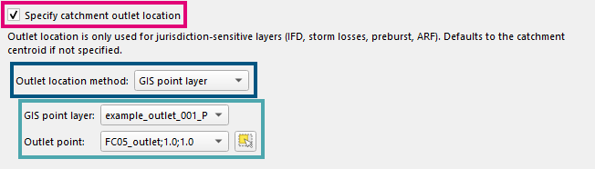
To specify an outlet location, check on the Specify catchment outlet location checkbox and then choose the Outlet location method from the combobox:
- GIS point layer: Specify the outlet location by selecting a GIS point layer and the specific Outlet point feature from the comboboxes. The outlet point feature can also be selected from the map using the 'select point feature' tool
 .
- Latitude/longitude: Specify the outlet location manually by entering the Outlet latitude and Outlet longitude.
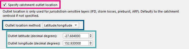
Outlet location is global
The outlet location setting applies to every catchment in the catchments table, it is not set on a per-catchment basis.
1.2 Outputs
Specify the location and format for the files output by this tool.
-
Output format The file format used for the rainfall hyetograph files, either
CSVorts1. -
Output location The location where the output files will be written to.

1.3 Intensity Frequency Duration (IFD)
-
IFD baseline year: the rainfall baseline year to use for the design rainfall depths.
-
2030 (default): uses the current climate baseline.
-
1990 (historical): uses the historical baseline.
-

1.4 Event Selection
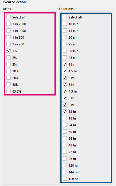
Select the storm event combinations. At least one AEP and one duration must be selected for the tool to run.
-
AEPs select the Annual Exceedance Probability (AEP) events to run.
-
Durations select the storm durations to run.
Output configuration JSON uses minutes
The output configuration .json file (see Saving Configurations) uses minutes for all duration events.
Frequent events are not available
The ARR to TUFLOW tool does not scrape the BOM website for IFD information. It relies solely on the ARR Data Hub. The ARR Data Hub does not currently provide IFD data for frequent events, therefore the tool does not currently support frequent events.