Changelog for TUFLOW Plugin v3.4
New Features and Enhancements
TUFLOW Viewer
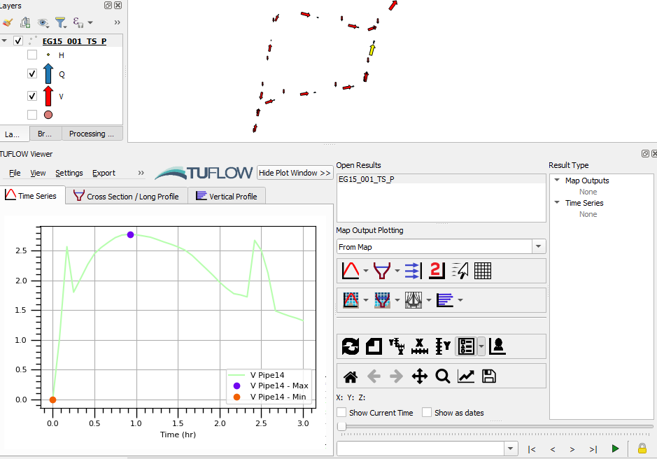
Support for ‘_TS_P’ GIS Outputs
Support for “quick viewing” ‘_TS_P’ output GIS layers (just open them in QGIS while TUFLOW Viewer is open). Not full featured (no axis names, does not populate time slider, no secondary axis etc).
Toggle Inactive Areas in Cross-Sections
User option added to view/hide inactive areas in 1D cross-sections. In-active areas are controlled by negative material/mannings n values in the cross-section.

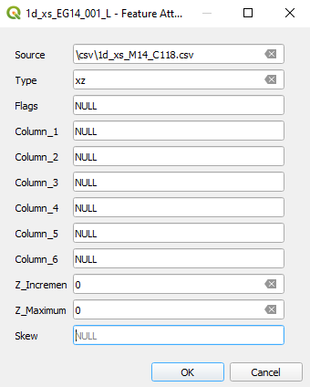
Cross-Section Source Leading With ‘/’
Cross-section source reference with a leading ‘/’ (or ‘\’) will now be interpreted the same as ‘./’. Although this not correct (e.g. “./csv/cross_section.csv” is different than “/csv/cross_section.csv” especially in Linux), this is how TUFLOW currently handles leading slashes.
Support For Insets in Animation Export Tool
Animation export tool will now update temporal properties of all map windows in the print layout (i.e. support for insets).
1D Integrity Tool
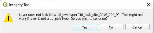
Error Downgraded to Warning When Input Checking
Now produces a warning instead of an error if the input layer doesn’t look like a 1d_nwk type.
TUFLOW Layer Styling
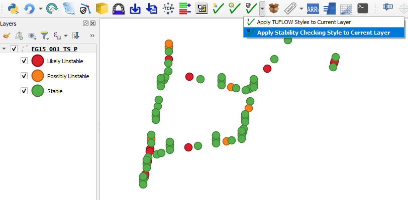
Stability Styling
A new styling button is located using dropdown arrow under ‘Style Current Layer’ button. This will automatically style the ‘_TS_P’ layer based on perceived stability.
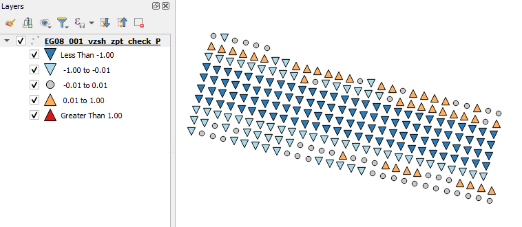
VZSH_ZPT_CHECK
Styling for vzsh_zpt_check.
NWK_C Check ‘all else’ On By Default
NWK_C check styling now has purple “all else” style visible by default.

ARR to TUFLOW
Assume Zero Values for NaN
If storm loss values are NaN from the datahub, the tool will now assume zero and produce an warning message in the output log file.
Additional Columns Added to Material.csv
Added additional columns (“Storage Reduction Factor” and “Fraction Impervious”) to material.csv output.

TUFLOW Utilities
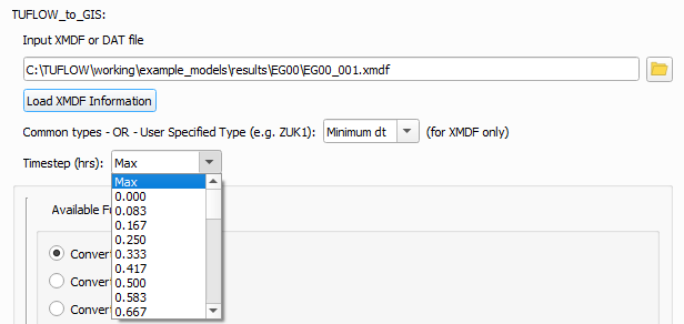
Increased Dropdown Box Width
Increased width of timesteps dropdown box for “TUFLOW to GIS” common tools.
Bug Fixes
TUFLOW Viewer
- Fixed bug that caused map to not update when clicking different result types after loading from a project
- Fixed a bug that was converting all length units to metres for 2D/3D cross-section plotting - will now use map canvas units
- Fixed a bug that would incorrectly show the maximum water level on 1D cross-sections
- New method of loading result from TCF was sometimes incorrectly loading in results that weren’t selected by the user
Other
- Import Empty - Fixed bug when choosing option to ‘Convert to GPKG’ that wouldn’t correctly create a GPKG layer with TUFLOW attributes or projection
- Load Layers From TCF - fixed loading GPKG layers that would sometimes fail to load
- Configure Project - Fixed ‘OK’ button that was disabled within the select CRS dialog